
KAILASA TREKS & EXPEDITIONS
Mt. Deo Tibba Peak
Himachal · 6001 mts · 15 Days
THE ROUTE
About this journey
Mt. Deo Tibba (6,001 m) , the second highest peak in the Pir Panjal range of Himachal Pradesh’s Kullu Valley, rises majestically above Jagatsukh village , southeast of Manali. Locally, it is revered as the gathering place of all the gods, where devtas are believed to convene and deliberate on important matters. Beyond folklore, what makes Deo Tibba truly captivating is its temperamental and unpredictable nature —each mood of the mountain is intense, making it one of the most intriguing climbs in the region.
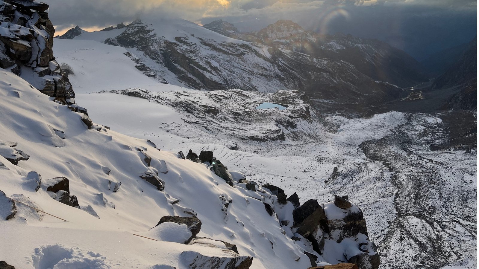
The expedition begins from Manali , a hub for trekkers and mountaineers, and unfolds as a serious mountaineering challenge. The ascent features two steep ice gullies and a permanent ice cap en route to the summit. The approach to Base Camp takes you through lush meadows bursting with wildflowers , sweeping mountain panoramas, and ever-changing cloudscapes. As you gain altitude, the terrain gradually transitions to barren rocks, moraines, and snow-covered slopes , culminating in a fully glaciated ascent.
A highlight of the climb is the formidable Duhangan Col , renowned for its steep and intimidating slopes—truly living up to its reputation. Unlike many peaks with sharp summits, Deo Tibba features a dome-shaped ice summit , a flat plateau-like top that sets it apart from other Himalayan peaks.
Certain sections demand technical climbing skills , including navigating ice gullies with 60–70° gradients , where the use of fixed ropes and mountaineering equipment is essential. This makes the expedition suitable only for experienced climbers who are proficient with ice axes, crampons, jumars, descenders, and roping techniques . For ambitious mountaineers aiming to conquer 6,000-meter-plus peaks and prepare for even higher climbs in the future, Mt. Deo Tibba offers an unparalleled training ground and an unforgettable Himalayan experience.
This page contains all the details for the Mt. Deo Tibba expedition , including route maps, itineraries, temperature charts, photos, videos, and reviews.
Route details are based on Kailasa’s published trip page. Terrain, weather and permits can change the plan.
DAY BY DAY
Itinerary
The schedule below follows the published route. The guide may adjust it for mountain conditions and team safety.
01Day 1: Make your way to Manali (2,050 m)
Participants arrive in Manali and settle into their accommodation.
Introduction and briefing on the expedition
Orientation on schedule, basic mountain rules, and environmental responsibility Overnight: Hotel in Manali
02Day 2: Rest and Acclimatization in Manali (2,050 m)
A day to acclimatize and prepare for the trek:
Go over packing list, buy missing gear
Test personal equipment like snow boots and crampons
Explore the town for light acclimatization Overnight: Hotel in Manali
03Day 3: Manali → Chikka (3,175 m)
Distance: 20 km drive + 4 km trek | Duration: 1 hr drive + 2 hr trek
Drive to Khanol (trailhead) via 40 hairpin bends
Trek through forested trails along Jagatsukh Nala
Open pastoral campsite at Chikka Overnight: Tents / Campsite
04Day 4: Chikka (3,175 m) → Seri (3,700 m)
Distance: 9 km | Duration: 5 hours trek
Gradual ascent through forest, birch trees, and alpine meadows
Cross rivers and streams; watch for wet patches
Evening acclimatization walk; first views of Deo Tibba dome Overnight: Tents / Campsite
05Day 5: Seri (3,700 m) → Tainta Base Camp (4,480 m)
Distance: 4 km | Duration: 4–5 hours trek
Trek across grasslands, stream crossings, and moraine fields
Small glacier patch requires caution
Evening acclimatization walk; spectacular views of Deo Tibba and Jagatsukh Peak Overnight: Tents / Base Camp
06Day 6: Rest and Acclimatization at Base Camp (4,480 m)
Acclimatization day with gear and ration distribution
Practice climbing techniques on nearby slopes
Optional hike to Chota Chandratal lake (if weather permits)
Small prayer for a safe and successful expedition Overnight: Tents / Base Camp
07Days 7–12: Expedition & Summit Push
Camps and Route:
Base Camp (4,480 m) → Camp 1 / Duhangan Col (5,100 m) : 6–7 hrs, 30° slopes, vertical ice gully (~60–65°)
08Camp 1 → Summit Camp (5,600 m) : Ice gullies, rock patches, knife-edge ridges
Summit Camp → Summit (6,001 m) : Gentle slopes, final roped sections
Descent: Summit Camp → Base Camp, 5–6 hrs, steep gullies and knife ridges Overnight: Tents at each respective camp
09Day 13: Base Camp → Manali (2,050 m) via Khanol
Distance: 18 km trek + 20 km drive | Duration: 5–6 hr trek + 1 hr drive
Retrace steps back to trailhead, Khanol
Drive back to Manali
Celebration of the expedition achievements in the evening Overnight: Hotel in Manali
10Day 14–15: Reserve Days
Reserved for bad weather or unforeseen delays affecting summit attempts.
BEFORE YOU BOOK
Inclusions & exclusions
These lists reflect the published trip page. Confirm the current quotation and what is supplied for your departure.
Included
- Food as per menu on the trek
- Forest Permits/Camping Charges, if any (upto the amount charged for Indian nationals)
- Tents, Sleeping bags, Sleeping mats
- Safety Equipment includes static rescue rope, seat harness, carabiners, pulleys
- Trek guide, cook, helpers, and porters for carrying common supplies
- Mountaineering course certified Trek Leader with Wilderness Emergency Responder & Rescue. course from NIM Uttarkashi
- Technical Equipment – Ropes, Helmet, Ice Axe, Crampons, Mountaineering Boots
- Accommodation in hotel in Manali on Day 1 and 2
- For More Kailasa Treks.
Not included
- Portage of personal bags during the trek
- Cost of any kind of Travel Insurance.
- Any Expense of personal nature.
- Any Expense not specified in the inclusions list.
- Meals during road journeys and Hotel stay are not included
- IMF Peak Booking Fee for foreign nationals USD 500 for a team of 2 members and USD 225 for every additional member up to 12 members.
- Mandatory Liaison Officer Fee for foreign expeditions ( ~USD 500 for group of 10)
- IMF deputed liaison officer is mandatory in case of foreign nationals. Expense of liaison officer is distributed amongst foreign nationals equally. Approximate total expense of LO : INR 15000/-
QUESTIONS TO CONSIDER
Trip questions
Where is Mt. Deo Tibba located?
Mt. Deo Tibba, standing at 6,001 meters, is in the Pir Panjal range of Himachal Pradesh, near Manali, above Jagatsukh village in the Kullu Valley.
How difficult is the climb?
The climb is highly technical, featuring steep ice gullies, a dome-shaped summit, and mixed terrain of snow, ice, and rocks. It is suitable only for experienced climbers with prior mountaineering knowledge.
What skills are required?
Climbers should have experience with crampons, ice axes, rope systems, jumars, and descending techniques. Knowledge of fixed rope navigation and glacier travel is essential.
What is the best season to attempt the climb?
The ideal months for climbing Mt. Deo Tibba are June to September , when the weather is relatively stable, and snow conditions are manageable.
How long is the expedition?
The typical expedition lasts about 15 days , including acclimatization, technical training, summit attempt, and descent.
TAKE THE NEXT STEP
Ask for the current trip plan.
Share your mountain experience and preferred dates. Kailasa can confirm the current itinerary, departure, price, equipment and eligibility.
Published base price on the source page: ₹74,999. Confirm the final quote and tax before booking.
Review the cancellation, privacy and booking terms before paying.